Background concepts:z Strictly
speaking, the Global Positioning System
is more than a network of 24 satellites.
It also includes the GPS ground-control
stations and the people who use receivers
to determine their position or to guide
navigation.
z When
the earth is represented as a sphere, the
lines that run around the globe from the
poles to the equator mark latitude. They
divide the earth into northern and
southern hemispheres. At right angles to
the latitudes, there are longitudinal
lines that divide the world into eastern
and western hemispheres. Together,
latitude and longitude are referred to as
coordinates, and are measured in degrees,
minutes and seconds. Each latitude
reading is accompanied by N or S (for
Northern or Southern hemisphere) and each
longitude reading is accompanied by E or
W (for Eastern or Western Hemisphere).
Latitude ranges between 0 and 90 degrees,
whereas longitude ranges between 0 and
180 degrees.
Useful facts:
č The
U.S. Department of Defense limits the
accuracy of GPS receivers employed by
unauthorized users to 100 m horizontally
(longitudinal and latitudinal position)
and 156 meters vertically (i.e.
elevation). This policy, referred to as
selective availability, was to be
suspended in late 1996, but has
apparently continued to this day.
č
Degrees of latitude are equally spaced,
but the slight flattening at the poles
causes the length of a degree of latitude
to vary from 110.57 km at the equator to
111.70 km at the poles. At the equator,
meridians of longitude 1 degree apart are
separated by a distance of 111.32
km ; at the poles, meridians
converge. Each degree of latitude and
longitude is divided into 60 minutes, and
each minute divided into 60 seconds,
there by allowing the assignment of a
precise numerical location to any place
on earth. [Encarta ‘96]
č This
means that in the tropics, a second
measures approximately 31 m and a minute
equals about 1.850 km.
č The
circumference of the earth at the equator
is over 40,000 km
Alternative methods:
Another way of finding your latitude
and longitude is to consult a topographic
map, but this is usually less precise and
requires more skill than using a GPS
receiver.
Applications:
GPS receivers are commonly used by
botanists to record the precise position
of collecting localities (that is, where
they have collected a certain plant or
animal). The receivers are also used to
describe specific localities named by
local people (toponyms), which are
usually of special importance to them.
Colleagues involved in community mapping
projects use GPS receivers to map key
topographical features. These data are
often incorporated in Geographical
Information Systems (GIS), which
integrate topographical, biological and
others types of observations in a single
computerized representation of the
landscape.
Related exercises (planned):
Documenting toponyms, Making
plant collections, Measuring
elevation with an altimeter, Community
mapping
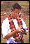
How to do it:
Although you will have to consult the
user’s guide of your specific GPS
receiver for details, the general
procedure is simple. Find a relatively
open spot near where you would like to
take your position. Turn the GPS receiver
on, and wait for a reading. The receiver
must be in contact with at least three,
and preferably four, satellites. You may
have to wait for several minutes, so you
may wish to turn the receiver on while
you are explaining to others how it
works.
Once you have a reading, record it in
a notebook with other relevant
information such as the local name of the
place, type of vegetation, topography,
slope and exposure (see Documenting a
toponym). If you are teaching this
technique in a workshop or course, you
can ask participants to find their
location on the face of the earth and on
a topographic map and world globe. Ask
them to observe the landscape around them
to see if it corresponds to the features
on the topographic map at the position
indicated by the receiver.
Practice saving the position
coordinates in the memory and giving the
location a name. Then walk to another
location and go through the procedure
again. When you have two or more
locations stored in the memory, you will
be able to calculate the distance from
one place to another, and design a path
that passes through the points. If you
record many points, you can map out the
trail that you took.
Tips:
l GPS
receivers use a lot of energy, so be sure
to bring along plenty of extra batteries
(usually AA alkaline batteries are used).
l
Although a GPS receiver will give you an
elevation reading when in contact with at
least four satellites, this measurement
is rarely as accurate as that given by an
altimeter
l GPS
receivers rarely work well under dense or
even moderate forest cover. One solution
is to purchase an antenna that can be
carried up into the tree canopy, but most
people simply walk to the nearest
clearing, such as a cultivated field,
forest gap or river.
Helpful Illustrations:
The February 1996 issue of Scientific
American has excellent illustrations
of how the Global Positioning Satellite
system functions (see cover and inside
pages). The Trimble guide book (pages
1-2, 1-3) is also a useful source of
illustrations. Microsoft Encarta ’96
has nice illustrations of the globe with
lines of latitude and longitude.
Example: none
References:
F GPS -
the Ninth Utility, an 80 page booklet
produced by Trimble
F
Herring, T.A. (1996) The Global
Positioning System. Scientific American,
February, pp. 44-50
Useful addresses:
Trimble (supplier of GPS receivers)
9020 - II Capitol of Texas Highway North
Phone +1.512.3438980
Suite 400 Fax +1.512.3459509
Austin, TX 78759
USA
Prepared by: GJ Martin, based on
experiences in various training
workshops.
|